NEWS お知らせ
Support for the Event through K-robot’s Geographic Information System (GIS)
Support for the Event through K-robot’s Geographic Information System (GIS)
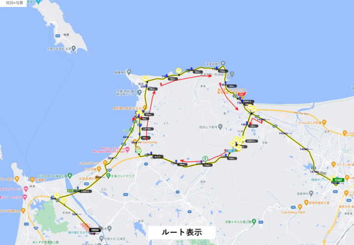
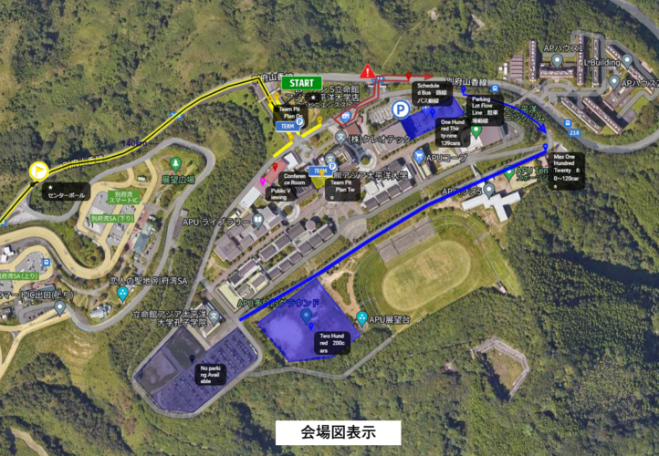
As a consulting partner of the “Mynavi Tour de Kyushu,” K-robot Co., Ltd. has been providing a Geographic Information System (GIS) to support the event’s operations since the first race. They will provide support again this year, contributing to streamlining and enhancing various operations.
-
Paperless Event Operations
By managing almost all event-related information in a database, we have significantly reduced the use of documents and files. -
Faster Information Sharing and Consensus Building
We utilize functions that allow quick sharing of information, streamlining communication and consensus-building with numerous organizations, including the Union Cycliste Internationale (UCI). -
Route Coordination with Local Governments and Communities
By leveraging functions that allow flexible information editing, we have improved communication and coordination with local governments and communities regarding event routes. -
Personnel and Task Management
By mapping the event day’s personnel plan on the GIS and adding attribute information, we facilitate efficient personnel planning, deployment, and withdrawal. -
Tracking of Event-Related Vehicles on Event Day
Through a dedicated app, we track event-related vehicles on the day of the event, displaying them on a map to help monitor the overall race situation.
Through these efforts, we are contributing to the safe and secure management of the event while promoting paperless and energy-efficient planning. This enables more efficient event operations. Additionally, by actively adopting advanced technology and implementing systems, we contribute to improving both the safety and entertainment value of cycling competitions overall.


